Feature Assessment: Built Environment / Farmsteads
# Farmsteads
| Overall vulnerability |  |
# Features assessed:
- Diverse mix of farmsteads within villages and more isolated locations
- Small and medium sized farmsteads with a wide variety of layouts
- Late 18th and 19th century farmsteads
# Special qualities:
- Landscapes that tell a story of thousands of years of people, farming and industry
- Characteristic settlements with strong communities and traditions
# Feature description:
A farmstead is the term for a farm and its associated buildings. Traditional farm buildings are a familiar sight across all areas of the Peak District National Park. Mapping has revealed there are a total of at least 2,523 farmsteads in varying forms within the PDNP.
They are an important feature of the historic character of the landscape. The relationship of farmsteads to field patterns is also regarded as very important, especially to irregular enclosure, medieval strip fields and common lands.
See ‘Field barns and outfarms’ for more detail on these features. This assessment only focuses on farmsteads
# How vulnerable are farmsteads?
Farmsteads in the PDNP have been rated ‘moderate’ on our vulnerability scale. This score is due to high sensitivity and exposure to climate change variables but a positive current condition, and a high adaptive capacity.
Although there are farmsteads which are disused, derelict or have been changed in use, the position within the PDNP is better than the status nationally. Farmsteads are sensitive to changes in agriculture, and although some funding is available for their conservation it is very limited and their future is uncertain.
# Current condition
Farmsteads are under increasing threat. Changes to farming practices mean buildings become redundant which can lead to dereliction and loss – in turn changing the landscape and historic character of an area.
A very low proportion of farmsteads are designated heritage assets and the condition of many is in visible decline, particularly the more isolated buildings.
Uncertainty over the future of upland farming and the need to diversify means that there is increasing pressure for conversion. Buildings that fall out of use are more likely to become derelict, see also ‘Field barns and outfarms’ for more information on this.
Mapping has revealed that in some areas of the UK up to two thirds of farmsteads are no longer in agricultural use. The highest rates of survival in agricultural use are concentrated in the uplands and their fringe.
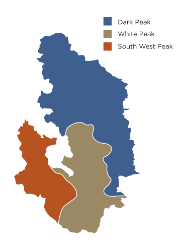
The PDNP has a very high survival rate of farmsteads – almost 90% of farmsteads have heritage potential because they have retained some or all of their historic form. There is a fairly diverse spread of locations as well as layouts and configurations with survival rates the highest in the White Peak and lowest in the Dark Peak. Distinct patterns of date, layout, type and survival of farmsteads within the Peak District can be related to the local geology, topography and landscape character areas.
# What are the potential impacts of climate change?
| Overall potential impact rating |  |
# Human behaviour change
Upland farmsteads are likely to be sensitive to changes in farming economics as a result of climate change. It may lead to buildings becoming redundant, refurbishment uneconomic and an increased demand for housing meaning greater pressure for conversions for residential use or holiday lets. Data Certainty: High
Measures to mitigate climate change such as moves to improve and upgrade the thermal efficiency of buildings such as increasing insulation or installing solar panels on roofs may potentially have a negative impact. If ventilation is reduced as a result it may increase rot of wood and insect infestation, leading to deterioration in wooden framed buildings and slate roofs, and changing the character of the roof scape. Building regulations may also be at odds with the way historic stone buildings are designed so could create problems, especially for unlisted buildings. This in turn could see the loss of the historic significance and character of farmsteads within the PDNP. Data Certainty: Very Low
Changes in agricultural practices, farm diversification and amalgamation, and changes in settlement patterns, could have the result of gradually eroding the relationship between farmsteads and their landscape context. Data Certainty: Moderate
# Direct impacts of climate change
These historic structures have the potential to be severely damaged by any increase in flooding, especially in locations within the landscape which are vulnerable to flooding and rain runoff. Structures could be damaged or weakened directly by hydraulic action and increase in flow of sediment or debris while repairs for repeated flooding may be uneconomic and lead to abandonment. A lack of understanding of how historic buildings are designed can lead to inappropriate interventions being taken, themselves creating further problems. Data Certainty: Very Low
Building materials are also sensitive to fluctuations of temperature causing increased thermal expansion and contraction of materials in particular wood, stone, metal, and paint. This can accelerate damage to building materials. Data Certainty: Moderate
Wet masonry and other building materials such as mortar are sensitive to frost, especially repeated freeze-thaw, and may be unable to cope with additional rainfall amounts and intensity. This may damage masonry, slates and other building materials. Data Certainty: Moderate
# Sedimentation or erosion
In addition to wetter warmer weather having the potential to increase erosion through hydraulic action, periods of high temperatures and drought may also see the ground dry out and crack which could make building materials susceptible to damage compromising the overall long term robustness of structures. Data Certainty: Low
# Invasive or other species interactions
Increased humidity could see a rise in mould growth in buildings, rot, and insect infestation, with any damage caused potentially needing intrusive renovation work. Changes in atmospheric conditions including increased carbon dioxide levels, coupled with wetter warmer winters may potentially see an increase in the growth in some plant species like Japanese knotweed or trees or shrubs, and therefore speeding up the rate of damage to structures. Data Certainty: Low
# What is the adaptive capacity of farmsteads?
Overall adaptive capacity rating |  |
When compared to the rest of the UK, the PDNP has a very high survival rate of farmsteads with 2,523 mapped. This does not include approximately 2,600 field barns and outfarms which are assessed separately. These farmsteads are found across all areas and include a diverse spread of locations and a variety of layouts and configurations. Survival rates are highest in the White Peak and lowest in the Dark Peak. Data Certainty: High
To date, traditional building materials and construction techniques have proved resilient to age – but the availability of economic resources to adapt and maintain farmsteads plays an important role in their survival. Data Certainty: Very Low
When it comes to making alterations to farmsteads, the planning system means many changes to building materials and adaptations to listed buildings can be controlled. However for unlisted buildings there is less control. In the PDNP as in the rest of the country a low proportion of farmsteads are designated heritage assets. Data Certainty: Moderate
Funding has been available through Countryside Stewardship schemes to help maintain or conserve farmsteads – however these resources are limited and their future uncertain. The highest level of financial support for landscape and heritage in England that includes the maintenance and weatherproofing of traditional farm buildings is the Countryside Stewardship and the Rural Development Plan for England. Such schemes have been particularly popular in the upland areas, where a high proportion of traditional farm buildings remain in agricultural use, but these areas are particularly sensitive to changes in environmental land management schemes. What will happen to these schemes in the future will depend on what the priorities are post-Brexit and any new regulations for rural development. Data Certainty: Moderate
Information and advice on making adaptations is readily available from various sources including the PDNPA. Whether change can be made however is less certain, as it also depends on the individual property owners, their building use and their economic situation - which are all factors in the likelihood of adaptations being sought. Data Certainty: Very Low
# Key adaptation recommendations for farmsteads
# Improve current condition to increase resilience
The current condition of a feature is an important factor alongside its sensitivity and exposure, in determining its vulnerability to climate change. These recommendations are aimed at improving the condition of the feature at present, therefore making it better able to withstand future changes to climate.
- Use existing PDNPA farmsteads research to understand regional patterns and help inform decisions about change, taking advantage of advice from PDNPA officers – both farm advisors and buildings and archaeological specialists.
- Adapt traditional farm buildings where appropriate so they may still be used beneficially.
- See Peak District Farmsteads: Issues and Responses Report (2017), section 6.2 ‘Recommendations’ for further information.
# Adaptations that could aid other features
These recommendations are changes that could be made to this feature, which will have a positive impact on the ability of other vulnerable features to withstand future climate change.
- Consider keeping buildings standing for the benefits of wildlife.